Experience Vietnam’s hidden gems with VRTO, an Aadasia Group initiative, where authentic cultural adventures and responsible tourism come together in community-driven journeys.
Cao Bang, a mountainous province in northern Vietnam, captivates visitors with its stunning landscapes of limestone peaks, rice terraces, and pristine waterfalls like Bản Giốc. Home to diverse ethnic minorities, including the Tay, Nung, Dao, and H’mong, the region offers rich cultural experiences through traditional crafts and festivals. As a less-traveled destination, Cao Bằng provides authentic adventures for those seeking to explore Vietnam’s natural beauty and cultural heritage.


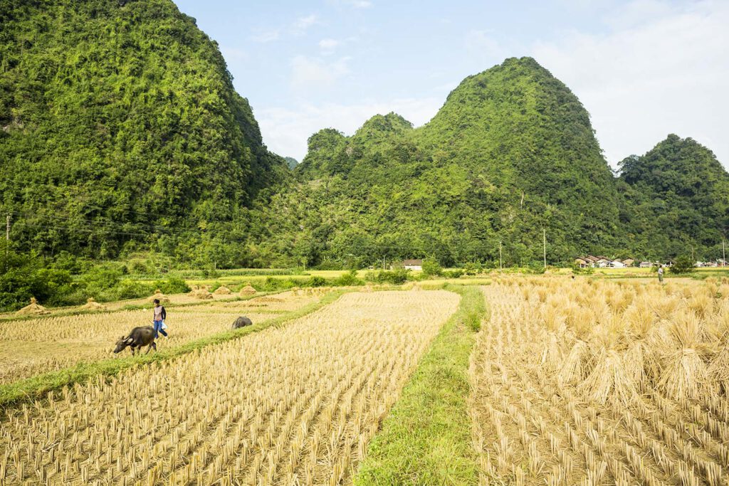
The mountainous province of Cao Bang is one oft he most scenic and beautiful regions in Vietnam. The province shares a 340 km long border with Guangxi province of southern China to the north, Ha Giang province to the west and Bac Kan and Lang Son provinces to the south. 90% of the landscape in Cao Bang is covered by forests that guarantee fresh and clean air all year round. Majestic karst peaks, limestone caves, spectacular waterfalls such as Ban Gioc, rice paddies, thin winding roads and countless small ethnic minority villages make the rugged beauty of this frontier region. Cao Bang is a region often overlooked by tourists which means that its unique beauty and culture have been well preserved. The remoteness and natural beauty make Cao Bang the perfect place for adventurous travelers looking for an escape from overcrowded tourist areas in Vietnam.


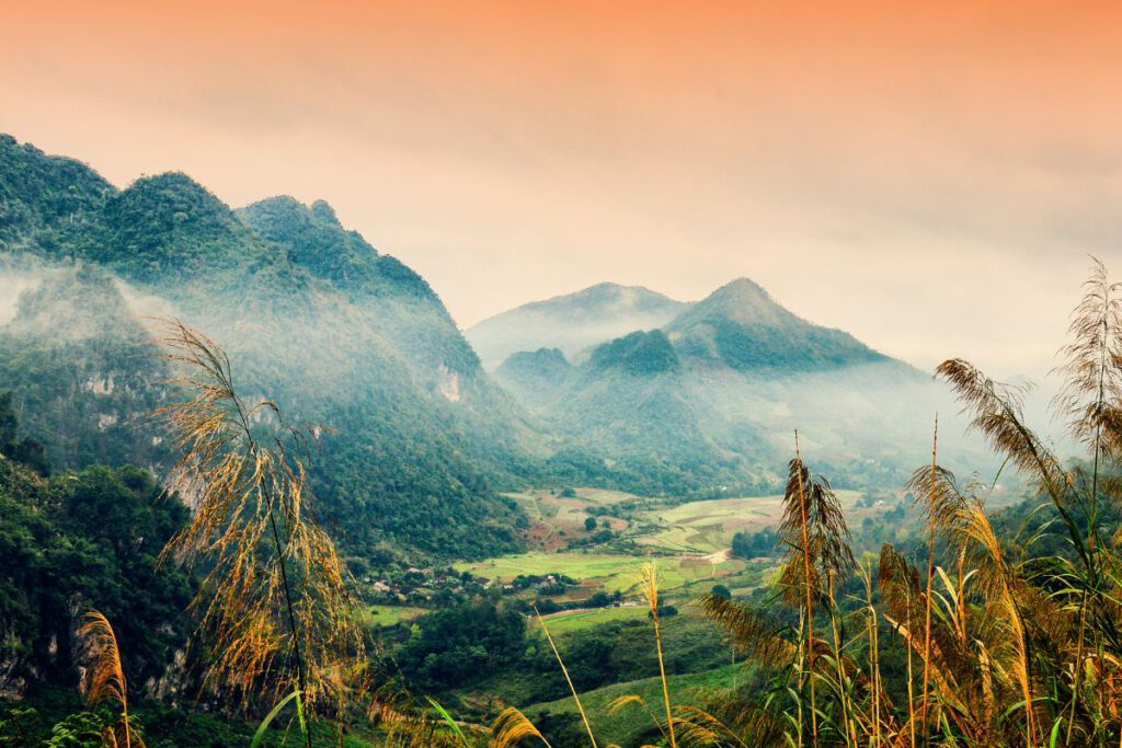
Cao Bang has a fairy-tale landscape of conical limestone peaks, secluded valleys and dense forests. The limestone plateau interspersed with mountains has an average altitude of over 200 meters while the areas bordering China are located higher at an altitude of 600-1300 metres. The mountainous topography makes travelling time-consuming with very limited options for public transport. Due to its northerly location and the influence of cold waves from China, Cao Bang has a cooler climate than the rest of Vietnam. The province has a temperate climate with four seasons. Summers are hot and humid with an average temperature of 25-28°C in summer and 16-17°C in winter. Lowest temperatures of 5-8°C are recorded in winter between December and February and some of the higher peaks even can see snow fall during cold spells.
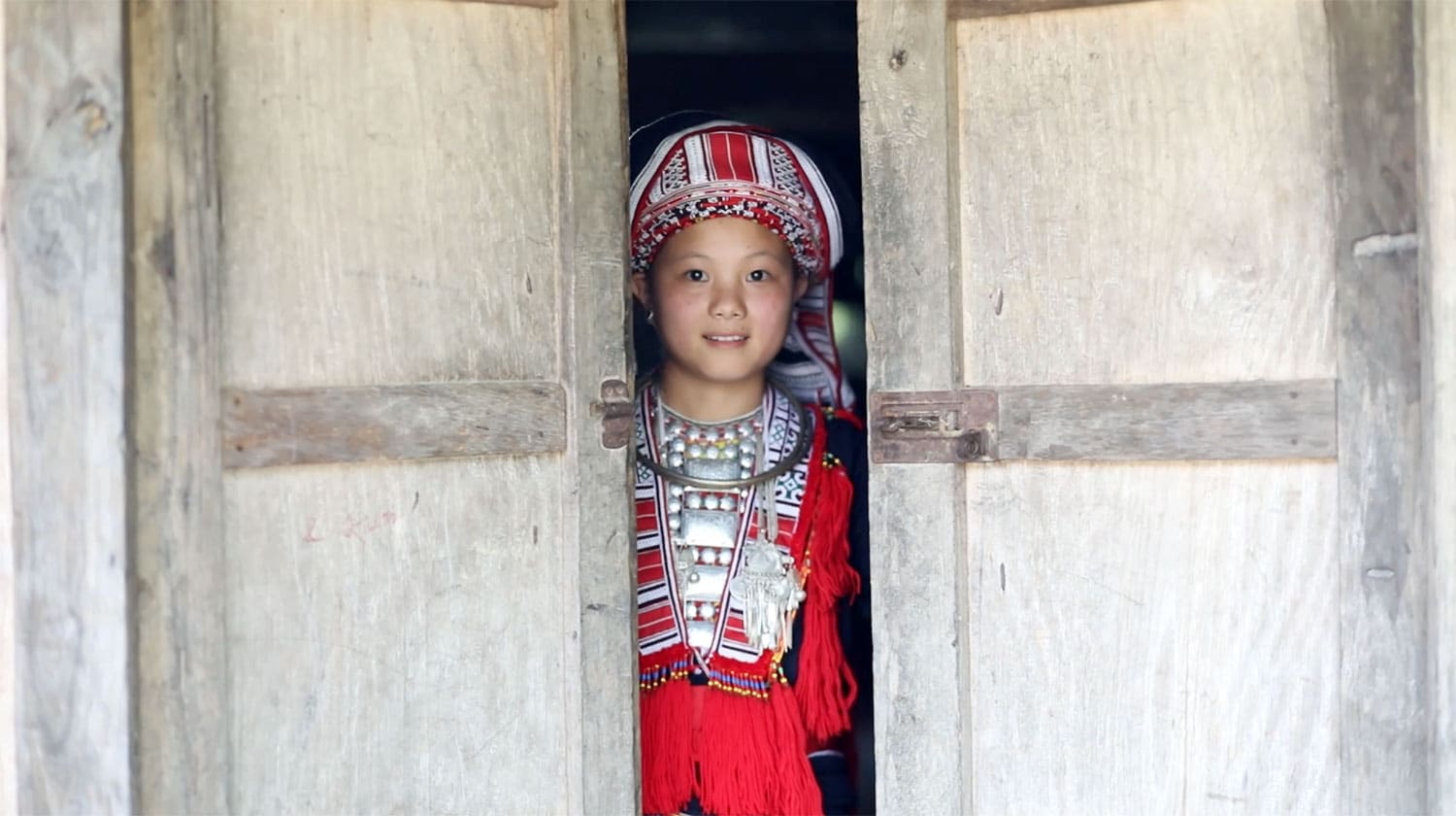
More than 90% of Cao Bang’s population are ethnic minorities. This is due the fact that the Vietnamese majority population (called Kinh or Viet) tended to avoid mountainous regions such as Cao Bang in favour of better farmland in the lowlands. The main ethnic groups living in Cao Bang are the Tay (41% of the population), Nung (31%), Dao (10%) and H’mong (10%). The diverse ethnic groups make for a unique mix of cultures and beliefs in the province. Most ethnic minority people in Cao Bang still wear their traditional costumes and there are many villages specialised in different crafts such as weaving, incense making, tile making and blacksmith. Tay, the largest minority group, have their own handwriting and unique festivals such as Long Tong and Moi Me Tran. Long Tong festival is held on the 4th day of the lunar year to worship the God of agriculture and pray for a bountiful harvest in the coming year. It is celebrated with offering food for the God, traditional games, folk-song singing contests and many other activities. Moi Me Trang which means Mother Moon Festival is another Tay festival. During the festival Tay people will ask the moon for luck and pray for prosperity. The celebrations feature traditional singing, flower offerings as well as cultural activities and games.

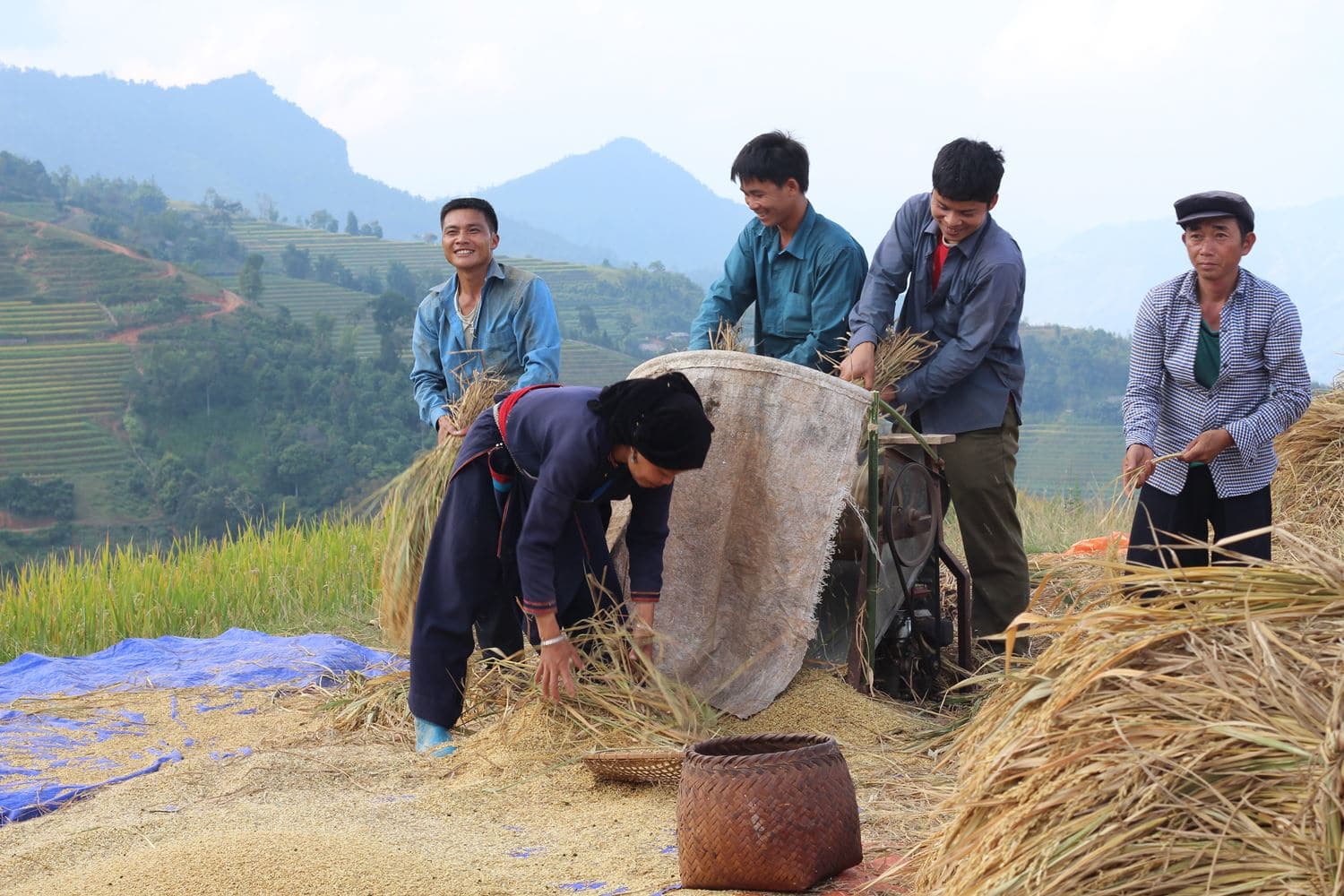
Ethnic groups in Cao Bang primarily live on farming. Rice and maize is the main source of income and farmed even on steep mountainsides. Highest farming is practised by the H’mong ethnic minority which usually live above 800 metres. They face difficult conditions such as insufficient amount of water to irrigate their small plots of land. Animal husbandry is another source of income for ethnic minorities in Cao Bang. However their lack of knowledge of animal rearing techniques means that productivity and income is rather low. Consequently, poverty rate in Cao Bang’s population is high at over 20%. Treatable illnesses such as diarrhea and gynecological diseases are common. Many households still use unsafe water collected from wells, streams or underground spring water. In remote districts there are still many schools with no water and sanitation facilities. Despite living under difficult conditions the people of Cao Bang are very friendly and curious to welcome visitors from abroad.
Food in Cao Bang is natural and and dominated by what different seasons have to offer. Duck is a very popular meat in Cao Bang. It is served for example as marinated roast duck and fried duck cakes (Bánh ap chao). Bánh áp chao is made of rice, sticky rice flour and duck meat and looks like a fried Chinese donut. The ingredients sticking closely together are seen as a symbol of the unity of the extensive family in Cao Bang. Banh cuon (rolled cake) is a popular breakfast dish. It is made from a thin sheet of fermented rice batter filled with a mixture of cooked seasoned ground pork, minced wood ear mushroom and minced shallots. Xoi tram Cao Bang is a regional version oft he classic Vietnamese dish sticky rice. The rice is mixed with fruit from the Carnarium tree to give it a purple colour. Cao Bang has some special dishes that feature insects as ingredients. One oft hem is Ant Eggs Cake (Bánh Trung Kien). In the middle of April and May every year, Tay ethnic people go to the forest to collect ants’ eggs. The eggs are the mixed with green bean cake and wrapped in fig leaves to create a unique, seasonal and highly nutritional delicacy.
When is the best time to visit Cao Bang?
Cao Bang has a mild, cool climate for Vietnam and is suitable for tourism all year round. Spring from February to May is probably the most comfortable time to visit as it is not too hot or wet. If you plan to visit Ban Gioc waterfall and want to see it when it is at its best you should visit in August and September. During that time the waterfall is most mighty and the water is deep blue and clear. If you are more of a winter person you should visit during the coldest months of November to January. The winter months might give you the chance to see snow covering the trees and mountains in Trung Khan or Tra Linh districts.
How to get to Cao Bang?
Cao Bang is located around 300 km from Hanoi. Every day there are many buses from My Dinh bus station to Cao Bang, both day and night buses. The journey takes around 7 hours. There are no trains or flights to Ha Giang (correct?).
What to prepare for your trip to Cao Bang?
Cao Bang is a mountain area so the sun’s rays might be stronger than in the lowlands. We therefore recommend you to bring a hat and sunscreen. Please also bring along your passport. Foreigners occasionally get checked their identity at the border region to China. In summer you should definitely bring a rain coat or umbrella. A rain coat will be better if you drive a motorbike.
The mountainous province of Cao Bang is one oft he most scenic and beautiful regions in Vietnam. The province shares a 340 km long border with Guangxi province of southern China to the north, Ha Giang province to the west and Bac Kan and Lang Son provinces to the south. 90% of the landscape in Cao Bang is covered by forests that guarantee fresh and clean air all year round. Majestic karst peaks, limestone caves, spectacular waterfalls such as Ban Gioc, rice paddies, thin winding roads and countless small ethnic minority villages make the rugged beauty of this frontier region. Cao Bang is a region often overlooked by tourists which means that its unique beauty and culture have been well preserved. The remoteness and natural beauty make Cao Bang the perfect place for adventurous travelers looking for an escape from overcrowded tourist areas in Vietnam.


Cao Bang has a fairy-tale landscape of conical limestone peaks, secluded valleys and dense forests. The limestone plateau interspersed with mountains has an average altitude of over 200 meters while the areas bordering China are located higher at an altitude of 600-1300 metres. The mountainous topography makes travelling time-consuming with very limited options for public transport. Due to its northerly location and the influence of cold waves from China, Cao Bang has a cooler climate than the rest of Vietnam. The province has a temperate climate with four seasons. Summers are hot and humid with an average temperature of 25-28°C in summer and 16-17°C in winter. Lowest temperatures of 5-8°C are recorded in winter between December and February and some of the higher peaks even can see snow fall during cold spells.
More than 90% of Cao Bang’s population are ethnic minorities. This is due the fact that the Vietnamese majority population (called Kinh or Viet) tended to avoid mountainous regions such as Cao Bang in favour of better farmland in the lowlands. The main ethnic groups living in Cao Bang are the Tay (41% of the population), Nung (31%), Dao (10%) and H’mong (10%). The diverse ethnic groups make for a unique mix of cultures and beliefs in the province. Most ethnic minority people in Cao Bang still wear their traditional costumes and there are many villages specialised in different crafts such as weaving, incense making, tile making and blacksmith. Tay, the largest minority group, have their own handwriting and unique festivals such as Long Tong and Moi Me Tran. Long Tong festival is held on the 4th day of the lunar year to worship the God of agriculture and pray for a bountiful harvest in the coming year. It is celebrated with offering food for the God, traditional games, folk-song singing contests and many other activities. Moi Me Trang which means Mother Moon Festival is another Tay festival. During the festival Tay people will ask the moon for luck and pray for prosperity. The celebrations feature traditional singing, flower offerings as well as cultural activities and games.

Ethnic groups in Cao Bang primarily live on farming. Rice and maize is the main source of income and farmed even on steep mountainsides. Highest farming is practised by the H’mong ethnic minority which usually live above 800 metres. They face difficult conditions such as insufficient amount of water to irrigate their small plots of land. Animal husbandry is another source of income for ethnic minorities in Cao Bang. However their lack of knowledge of animal rearing techniques means that productivity and income is rather low. Consequently, poverty rate in Cao Bang’s population is high at over 20%. Treatable illnesses such as diarrhea and gynecological diseases are common. Many households still use unsafe water collected from wells, streams or underground spring water. In remote districts there are still many schools with no water and sanitation facilities. Despite living under difficult conditions the people of Cao Bang are very friendly and curious to welcome visitors from abroad.
Food in Cao Bang is natural and and dominated by what different seasons have to offer. Duck is a very popular meat in Cao Bang. It is served for example as marinated roast duck and fried duck cakes (Banh ap chao). Bánh áp chao is made of rice, sticky rice flour and duck meat and looks like a fried Chinese donut. The ingredients sticking closely together are seen as a symbol of the unity of the extensive family in Cao Bang. Banh cuon (rolled cake) is a popular breakfast dish. It is made from a thin sheet of fermented rice batter filled with a mixture of cooked seasoned ground pork, minced wood ear mushroom and minced shallots. Xoi tram Cao Bang is a regional version oft he classic Vietnamese dish sticky rice. The rice is mixed with fruit from the Carnarium tree to give it a purple colour. Cao Bang has some special dishes that feature insects as ingredients. One oft hem is Ant Eggs Cake (Banh Trung Kien). In the middle of April and May every year, Tay ethnic people go to the forest to collect ants’ eggs. The eggs are the mixed with green bean cake and wrapped in fig leaves to create a unique, seasonal and highly nutritional delicacy.
When is the best time to visit Cao Bang?
Cao Bang has a mild, cool climate for Vietnam and is suitable for tourism all year round. Spring from February to May is probably the most comfortable time to visit as it is not too hot or wet. If you plan to visit Ban Gioc waterfall and want to see it when it is at its best you should visit in August and September. During that time the waterfall is most mighty and the water is deep blue and clear. If you are more of a winter person you should visit during the coldest months of November to January. The winter months might give you the chance to see snow covering the trees and mountains in Trung Khan or Tra Linh districts.
How to get to Cao Bang?
Cao Bang is located around 300 km from Hanoi. Every day there are many buses from My Dinh bus station to Cao Bang, both day and night buses. The journey takes around 7 hours. There are no trains or flights to Ha Giang (correct?).
What to prepare for your trip to Cao Bang?
Cao Bang is a mountain area so the sun’s rays might be stronger than in the lowlands. We therefore recommend you to bring a hat and sunscreen. Please also bring along your passport. Foreigners occasionally get checked their identity at the border region to China. In summer you should definitely bring a rain coat or umbrella. A rain coat will be better if you drive a motorbike.